Monday, July 11, 2011

Utah Trip - Arches National Park Day 1

     On the 10th day of our visit to Utah, we got up early to hike in Arches National Park. Unfortunately, the weather was not very cooperative as it rained.  We drove the scenic road in Arches to get the "lay of the land", but wound up back at the hotel.  After a refreshing A.M. nap, we headed back to the park for our first hike.  We started with a 2 mile round-trip warm-up on a trail named Park Avenue. 
The hike is on a dry river bed(which due to the morning rain was not as dry as it usually was) with towering rock formations on either side - hence the trail's name "Park Avenue".
      From our warm-up hike, we did the premier hike in Arches - the Devil's Garden Trail.  This trail, over 7 miles with all its side trails, takes you past at least 7 arches including Landscape Arch said to be the longest in the world over 300 feet in length.

After passing Landscape Arch the trail gets a little tricky passing along the rib of some very steep and narrow "fins".  While attempting to cross one of the fins, we got caught in a sleety downpour which made the rock incredibly slick.  The storm was short-lived and we made it through to Double O Arch.
Past the Double O Arch the trail is labelled as "primitive", but it was easy to follow with a couple of tricky spots and some interesting views.
We finished our first day at Arches with a 3 mile round trip hike to the "most photographed arch in the world" - Delicate Arch

Tuesday, July 5, 2011

Utah Trip - Canyonlands National Park

   After starting our day with the hike to Hickman Bridge in Capitol Reef National Park, we headed north and east to our next destination.  Canyonlands National Park is divided into three distinct section:  Island in the Sky, The Needles, and The Maze.  We visited the Island in the Sky section which is a high plateau (5,000 feet in elevation) situated between the Green and Colorado Rivers.  After stopping at the Visitor Center, we took the scenic drive to the White Rim Overlook where a half mile hike brings you to the edge of the mesa.  The White Rim is a continuous layer of sandstone some 1,200 feet below the edge of Island in the Sky. Another 1,000 feet below the White Rim  are the rivers.
 From here we moved on to Murphy Point a 3.6 mile round trip hike that provides vistas of the Green River Canyon.
We also took a short hike along the rim of Upheaval Dome.  It is an interesting geologic feature whose origin is open to question.  Upheaval Dome is actually a huge hole in the earth.  One group of scientist believe that it was created by the collapse of an underground salt dome.  Another group believes that it may have been cause by a meteor striking the earth.  Either way it was an interesting hike.
Our last hike was to the Mesa Arch, which sits right on the rim of Island in the Sky.
As the arch sat right on the rim, this is about as close as I got to it.  Nan however, climbed up to get a look.  This time I gave her my camera.
From here we headed into Moab, Utah to spend the night.

Monday, June 27, 2011

Utah Trip - Capitol Reef National Park

We stayed in Torrey, Utah, just outside Capitol Reek National Park, for 2 nights.  Capitol Reef is part of what is known as the Waterpocket Fold.  The Waterpocket Fold is a giant buckle in the earth's surface that stretches over 150 miles through south-central Utah.  It was created some 65 million years ago by a massive lifting of the earth's surface.
The park includes a 16 mile round trip scenic drive, several historic buildings, a fruit orchard that is still being operated, the Fremont River, natural arches, Native American petroglyphs, and the Pioneer Register.  The latter should better be called Pioneer Graffitii.  As pioneers passed through the narrow canyon now known as Capitol Gorge, they wrote their names on the walls of the canyon.

The Fremont River provides a steady source of water to the area.  As a result the early settlers turned to fruit production in order to make a living.  When the federal government created the national park, they took over operation of the orchards.  The view below is of the Gifford Farmhouse from the Cohab Canyon trail.  The farmhouse is maintained as a museum and store.

Our longest hike at Capitol Reef was on the Cohab Canyon Trail to the Frying Pan Trail to Cassidy Arch to The Grand Wash Road which was about 6.5 miles with elevation changes totalling almost 2,000 feet.  We were fortunate enough to meet a couple from England who offered us a ride back to the Visitor Center.  We gladly accepted as it was hot.  The picture below is of Cassidy Arch(Yes, it is named after Butch)

The fact that we got the ride gave us opportunity to take another hike up Capitol Gorge.

The next morning we hiked to Hickman Bridge, a natural arch named after a educator and Utah legislator who pushed to have Capitol Reef made a park.

Thursday, June 23, 2011

Utah Trip - Scenic Byway 12

The road from Bryce Canyon to Torrey, Utah, just outside of Capitol Reef National Park, has been designate a National Scenic Byway.  It travels more than 124 miles through slickrock canyons, red rock cliffs, pine and aspen forests, and alpine mountains.  It runs through the Grand Staircase-Escalante National Monument, Dixie National Forest, and past a number of state and national parks and historic sites.  Our first stop on leaving Byrce was the Kodachrome Basin State Park.
The basin was named by the National Geographic Society after a visit in 1949 during which the Society members felt the colors were rich and diverse and showed up well on Kodak's signature film.  We hiked about 4 miles through the park which features a variety of sandstone pillars.  From there we headed east through the Grand Staircase - Escalante National Monument and passing a number of impressive western landscapes.

One of the landscapes is called The Blues.

                           This picture doesn't do justice to the expanse of this blue-gray formation.

As we continued along Scenic Byway 12 we reached a spot called Head of the Rocks, which is a desolate area east of the village of Escalante.

Our next stop along the Byway was at the Anasazi State Park Museum.  This archaeological site gives the visitor a look at the life of  the Ancestral Pueblo who lived in the area of Boulder, Utah, between 800 A.D. and 1000 A.D.

The last section of the Byway climbs out of Boulder to almost 11,500 feet over the Aquarius Plateau to Torrey, Utah.  This portion of the road wasn't even paved until 1985 and was only a seasonal road prior to then.


Saturday, June 18, 2011

Utah Trip - Part 4 - Bryce Canyon

We spent a little over 2 days at Bryce Canyon National Park and did quite a bit of hiking (almost 20 miles).  Bryce is know for it Hoodoos, which are geological formations.  They are created after the the earth's surface has been uplifted and fractures and cracks are created.  Water seeps into the cracks, causing the rock to split.  Water then washes away the soil and exposes fins or ridges of rock.  The water continues to work on the exposed rock and creates windows in the rock.  Eventually the windows collapse leaving spires called hoodos.
Our first day we did a combination of the Navajo, Peekaboo, and Queens Garden trails for about 6.5 miles with quite a bit of up and down.  But the trails take right into the Bryce amphitheater and gives you a totally different perspective. Getting an early start in the National Parks avoids the traffic on the trails.  We were on the trail by 7:30 both days.
After the hike we had lunch at Sunset point and watched bus loads of tourist hope off their buses and then run back to their buses and on to the next stop.  Interestingly enough their were also quite a few French motorcycle tours.  Bryce Canyon has an 18 mile drive with a number of different viewpoints along the way.  You start at about 7500 feet elevation and finish at Rainbow Points 9115 foot mark.  Along the way we passed a natural arch.

On our second day we hiked the Fairyland Trail, which is an 8 mile loop. This is a picture of me in front of Boat Mesa.


 From there we had lunch at a secluded road side rest area further up the scenic drive not wanting to recreate the turmoil of the previous day luncheon.  We did another 4 mile hike into Swamp Canyon, which was interesting as it had been burned over several years ago.
After dinner we returned to Sunset Point.  Well you can't really see the sunset from Sunset Point.  But it was nice to see the effect that the sunset had on the canyon.

Wednesday, June 15, 2011

Utah Trip - Part 4 - Hikes and Moving On

I started our last day in Zion in bed while Nan decided to climb Angel's Landing.  I had a very nice breakfast meeting a couple from England and one from San Diego.  Nan called around 10 to say she had completed her hike. So I went and picked her up. She said the hike was steep but relatively easy until the last quarter to half mile which has scary sharp drop-offs on each side and a chain to hold on to in order to avoid a long fall.  She did it, but said she doesn't ever have to do it again.  Here's a picture she took with her phone from Scott's Landing on the way up.
We headed east through Zion where the road passes through a mile long tunnel.  Once exiting the tunnel we parked and hike 2.3 mile on the Canyon Overlook Trail to this view.

After our hike we headed south to Kanab, Utah.  As you may be aware Nan and I both volunteer at the Animal Protective Society of Durham.  Kanab is the home of Best Friends Animal Sanctuary and they welcome visitor.  Best Friends is a "no kill" shelter which is set a beautiful piece of land in Angel Canyon where they own 3,500 acres and lease 10,000 more.  It is the largest employer in Kanab with 450 workers.  The facilities are tremendous, and it was well worth the visit.

From Kanab we drove north toward Bryce Canyon National Park.  About 15 miles from Bryce we passed through Red Canyon where you start to see the rock formations that make Bryce famous.
On the way to our accommodations we noticed some snow on the hillsides.

Our innkeeper told us that just two days before it was like Christmas with 4 inches of heavy wet snow.  Just as glad we missed it. Settled down for the evening at the Bryce Country Cabins in Tropic, Utah.  We did squeeze in a short hike before sundown to a spot called Mossy Cave. Nice relaxing jaunt after a day of driving.


Thursday, June 9, 2011

Utah Trip - Part 3 - Zion Hikes Day 2

The classic "gotta do" hike in Zion is Angel's Landing.  The only trouble with this "gotta do" hike is that it ends with a half mile along a razor edged ridge with 1000' shear drop-offs on each side.  You have to share a knee height chain in order to traverse the ridge. This is not my idea of a comfortable hike.  Our host, who stated that he was also altitude challenged, suggested that we climb Observation Point.  This is an 8 mile round trip hike that ascends 2400 feet.  He said that there were some difficult spots on Observ. Pt. but not as bad as Ang Ld.  So off we went to climb Observation Pt.
The trail starts at the shuttle bus stop for the Weeping Rock and climbs steadily on a series of switchbacks.
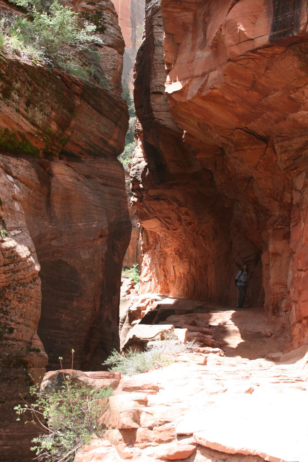
Once reaching the height of the land you turn away from the valley and enter a slot canyon that takes you up the backside of the mountain.

The trail continues to climb steeply until you reach a point where you have to walk along a rock ledge 3 to 4 feet wide with a 1500 foot at least dropoff on your right hand side.  This proved the fact that I am more altitude challenged than the B & B host as I turned around.(Later our host admitted that this spot was where he sat down and let his wife summit - which is what I did)  I did get some great shots looking back down the valley and of flowers.

Nan finished the hike.  We then went to Weeping Rock and Hidden Canyon Overlook.  Well actually Nan finished the Hidden Canyon hike as this trail too had a section with chains that you had to hold on to in order to cross an open rock face with dropoffs. (On this one you had to side step across the open sandtone face hanging on to the chains with your butt sticking out over the abyss)  Although I didn't complete the hikes, the scenery was tremendous and the weather good.